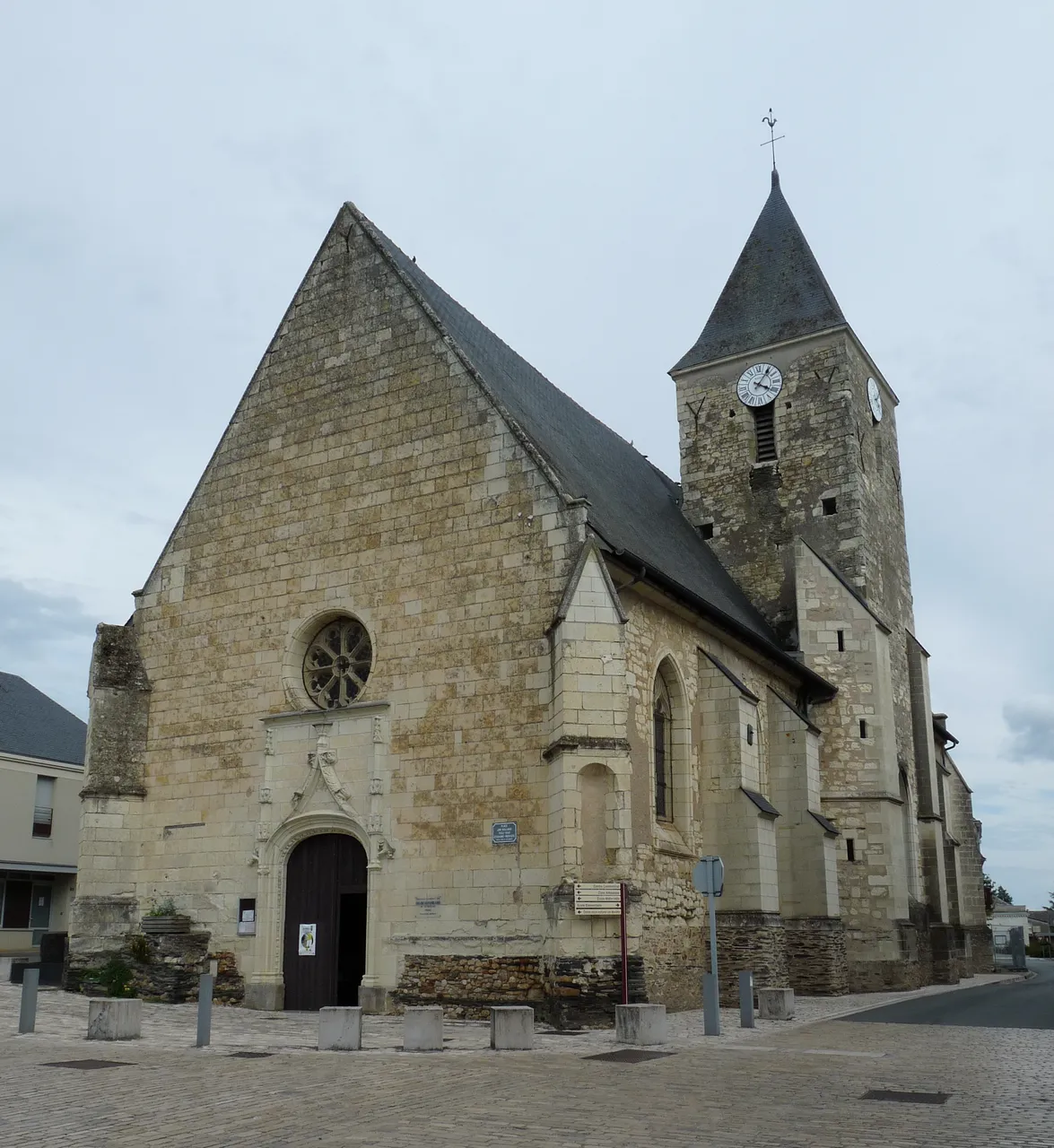
Eglise de Corné
église
Mérimée ID
PA00109062
French architectural heritage database reference.
Protection
Inscrit (1972)
Status under the French Heritage Act.
Identification & Protection
| Field | Value |
|---|---|
| Mérimée ID | PA00109062 |
| Type | église |
| Protection | inscrit MH |
| Protection year | 1972 |
| Period | 11e siècle;15e siècle;16e siècle;18e siècle |
| Ownership | propriété de la commune |
| Commune | Corné |
| Département | Maine-et-Loire |
Protection scope
Eglise (cad. AZ 228) : inscription par arrêté du 8 novembre 1972
View PA00109062 in the Mérimée database
Other 11e siècle monuments in Maine-et-Loire
- Eglise de Dénezé-sous-le-Lude (Dénezé-sous-le-Lude) — église
- Eglise de Aubigné-sur-Layon (Aubigné-sur-Layon) — église
- Eglise de Miré (Miré) — église
- Eglise de Saint-Melaine-sur-Aubance (Saint-Melaine-sur-Aubance) — église
- Eglise de Meigné (Meigné) — église
- Ancien hermitage Saint-Jean (Chênehutte-Trèves-Cunault) — Ermitage
- Château de Passavant de Passavant-sur-Layon (Passavant-sur-Layon) — Château
- Eglise de Bocé (Bocé) — église
Heritage typology of Maine-et-Loire
| Edifice type | Count |
|---|---|
| Château | 136 |
| église * | 131 |
| Maison | 70 |
| Manoir | 63 |
| Moulin | 35 |
| Hôtel | 27 |
| Chapelle | 27 |
| Dolmen | 22 |
| Menhir | 18 |
| Prieuré | 17 |
| Abbaye | 14 |
| Immeuble | 13 |
* This monument is a église — one of 131 in the département.
Location
GPS: 47.4712°N, -0.3511°E (WGS 84).
Source: Ministère de la Culture — base Mérimée. Updated: April 14, 2026.
Geographic location
location_on
Corné, Maine-et-Loire
Coordinates: 47.4712°N, -0.3511°E