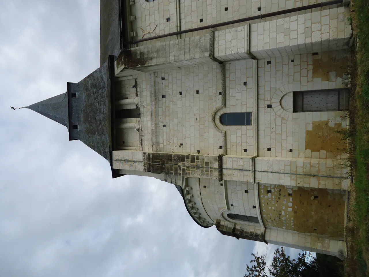
Eglise de Sarcé
église
Mérimée ID
PA00109964
French architectural heritage database reference.
Protection
Classé (1974)
Status under the French Heritage Act.
Identification & Protection
| Field | Value |
|---|---|
| Mérimée ID | PA00109964 |
| Type | église |
| Protection | classé MH |
| Protection year | 1974 |
| Period | 6e siècle;11e siècle;12e siècle |
| Ownership | propriété de la commune |
| Commune | Sarcé |
| Département | Sarthe |
Protection scope
Église (cad. D 53) : classement par arrêté du 22 mai 1974
View PA00109964 in the Mérimée database
Other 6e siècle monuments in Sarthe
- Eglise de Sainte-Osmane (Sainte-Osmane) — église
- Presbytère de Saint-Pierre-de-Chevillé (Saint-Pierre-de-Chevillé) — Presbytère
- Eglise Saint-Aubin de Pincé (Pincé) — église paroissiale
- Château de Poncé de Poncé-sur-le-Loir (Poncé-sur-le-Loir) — Château
- Eglise de Préval (Préval) — église
- Eglise de Saussay de Montfort-le-Gesnois (Montfort-le-Gesnois) — église
- Eglise de Bouër (Bouër) — église
- Manoir de la Danière de Amné (Amné) — Manoir
Heritage typology of Sarthe
| Edifice type | Count |
|---|---|
| église * | 101 |
| Château | 76 |
| Manoir | 39 |
| Maison | 35 |
| Voirie | 22 |
| Hôtel | 17 |
| église paroissiale | 15 |
| Chapelle | 11 |
| Prieuré | 9 |
| Menhir | 8 |
| Dolmen | 6 |
| Pont | 5 |
* This monument is a église — one of 101 in the département.
Location
GPS: 47.7215°N, 0.2208°E (WGS 84).
Source: Ministère de la Culture — base Mérimée. Updated: April 14, 2026.
Geographic location
location_on
Sarcé, Sarthe
Coordinates: 47.7215°N, 0.2208°E