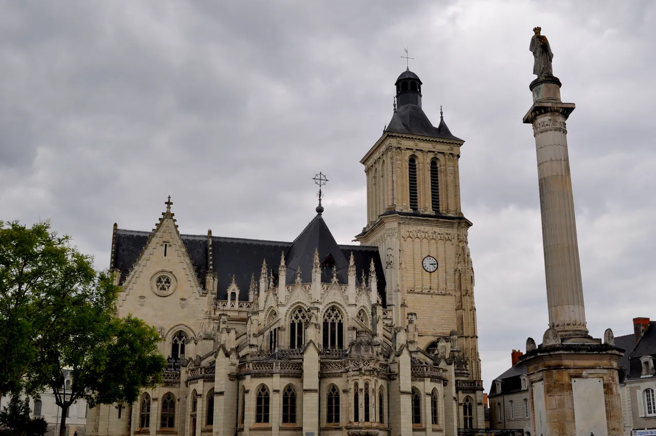
Eglise Notre-Dame de Beaufort-en-Vallée
église
Mérimée ID
PA00108962
French architectural heritage database reference.
Protection
Inscrit (1963)
Status under the French Heritage Act.
Historical notice
Eglise reconstruite dans les années 1500-1542, puis amplifiée et achevée de 1866 à 1877 sur les plans de l'architecte Beignet.
Protection timeline
| Date | Event |
|---|---|
| 12 December 1963 | inscrit MH |
| 6 April 1994 | inscrit MH |
Identification & Protection
| Field | Value |
|---|---|
| Mérimée ID | PA00108962 |
| Type | église |
| Protection | inscrit MH |
| Protection year | 1963 |
| Period | 1ère moitié 16e siècle;2e moitié 19e siècle |
| Attributed architect / author | BEIGNET Auguste (architecte) |
| Ownership | propriété de la commune |
| Commune | Beaufort-en-Vallée |
| Département | Maine-et-Loire |
Protection scope
Clocher (cad. AX 270) : inscription par arrêté du 12 décembre 1963 ; Eglise (cad. AX 270) : inscription par arrêté du 6 avril 1994
View PA00108962 in the Mérimée database
Heritage of Beaufort-en-Vallée
4 other protected monuments share this commune.
| Monument | Type | Protection | Year |
|---|---|---|---|
| Château de Beaufort-en-Vallée (ruines) | Château | inscrit MH | 1951 |
| Couvent des religieuses Hospitalières de Saint-Joseph-de-la-Flèche (ancien) | Couvent | classé MH partiellement | 1969 |
| Prieuré d'Avrillé (ancien) | Prieuré | classé MH partiellement;inscrit MH partiellement;protection partielle | 1972 |
| Manoir de Princé de Beaufort-en-Vallée | Manoir | inscrit MH partiellement | 1977 |
Other 1ère moitié 16e siècle monuments in Maine-et-Loire
- "Logis seigneurial dit "" château de Clefs "" ou manoir de Toury" (Clefs) — Manoir;château
- Ensemble immobilier du château du Verger (Seiches-sur-le-Loir) — Château;prieuré
- Ferme de Mongeville de Varennes-sur-Loire (Varennes-sur-Loire) — Ferme
Heritage typology of Maine-et-Loire
| Edifice type | Count |
|---|---|
| Château | 136 |
| église * | 131 |
| Maison | 70 |
| Manoir | 63 |
| Moulin | 35 |
| Hôtel | 27 |
| Chapelle | 27 |
| Dolmen | 22 |
| Menhir | 18 |
| Prieuré | 17 |
| Abbaye | 14 |
| Immeuble | 13 |
* This monument is a église — one of 131 in the département.
Location
GPS: 47.4403°N, -0.2171°E (WGS 84).
Source: Ministère de la Culture — base Mérimée. Updated: April 14, 2026.
Geographic location
location_on
Beaufort-en-Vallée, Maine-et-Loire
Coordinates: 47.4403°N, -0.2171°E