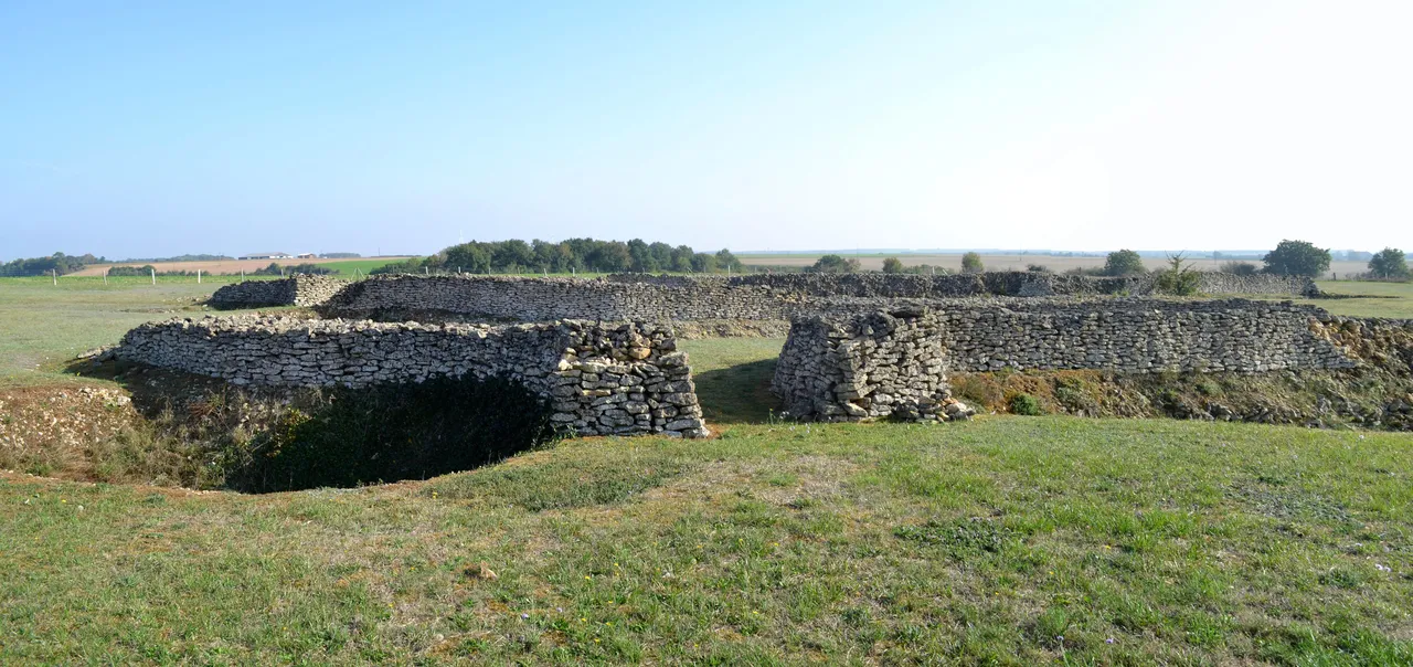
Enceinte préhistorique de Champ-Durand
site archéologique
Mérimée ID
PA00110301
French architectural heritage database reference.
Protection
Inscrit (1990)
Status under the French Heritage Act.
Identification & Protection
| Field | Value |
|---|---|
| Mérimée ID | PA00110301 |
| Type | Site archéologique |
| Protection | inscrit MH |
| Protection year | 1990 |
| Period | Préhistoire |
| Ownership | propriété privée |
| Commune | Nieul-sur-l'Autise |
| Département | Vendée |
Protection scope
Enceinte préhistorique de Champ-Durand (cad. AN 47, 48, 51 à 53, 55 à 70, 116, 117 ; ZP 36 à 38, 48, 53, 82 à 85) : inscription par arrêté du 26 juillet 1990
View PA00110301 in the Mérimée database
Other Préhistoire monuments in Vendée
- Camp retranché du Châtelard (Bessay) — Camp
- Eperon barré du Châtelet d'époque préhistorique dit Redoute romaine (L'Ile-d'Yeu) — Camp
- Enclos protohistorique (Saint-Avaugourd-des-Landes) — Site archéologique;camp
Heritage typology of Vendée
| Edifice type | Count |
|---|---|
| église | 86 |
| Château | 57 |
| Maison | 30 |
| Menhir | 28 |
| Manoir | 15 |
| Dolmen | 13 |
| Pont | 11 |
| Immeuble | 10 |
| Abbaye | 10 |
| Moulin | 8 |
| Prieuré | 7 |
| Phare | 7 |
* This monument is a site archéologique — one of 0 in the département.
Location
GPS: 46.4150°N, -0.6570°E (WGS 84).
Source: Ministère de la Culture — base Mérimée. Updated: April 14, 2026.
Geographic location
location_on
Nieul-sur-l'Autise, Vendée
Coordinates: 46.4150°N, -0.6570°E