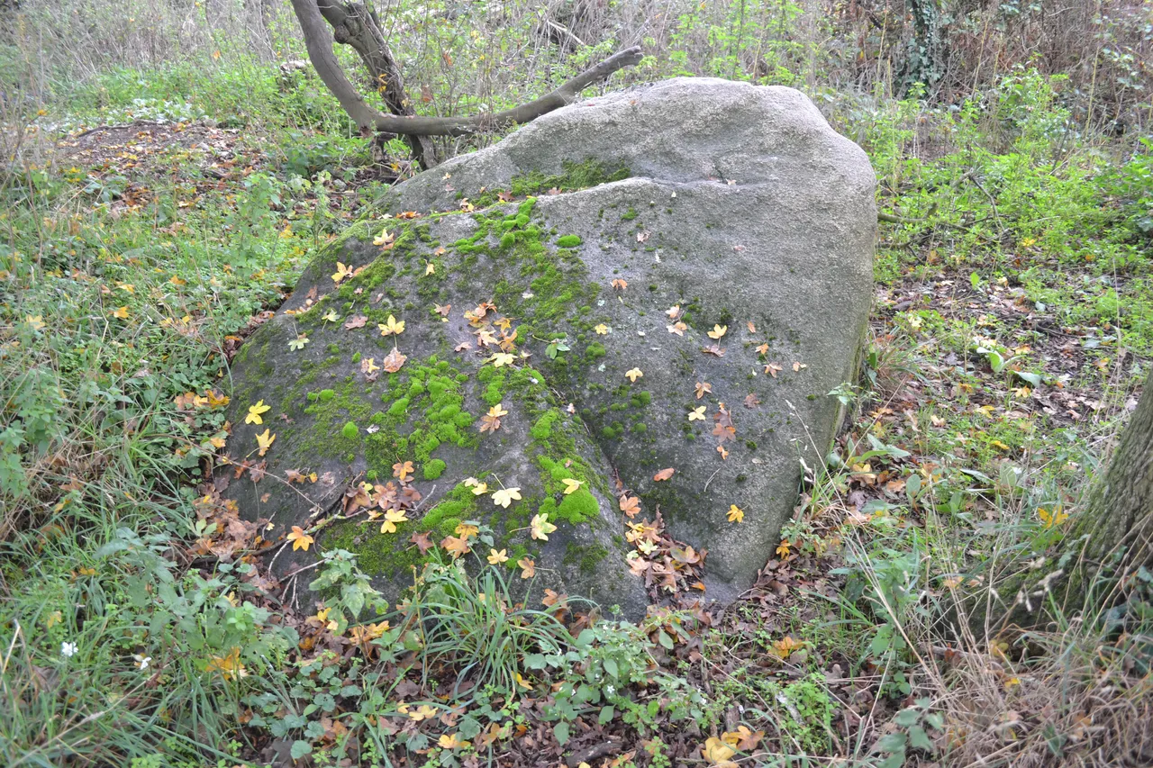
Menhir à cupules de Saint-André-des-Eaux
menhir
Mérimée ID
PA00108788
French architectural heritage database reference.
Protection
Classé (1889)
Status under the French Heritage Act.
Identification & Protection
| Field | Value |
|---|---|
| Mérimée ID | PA00108788 |
| Type | Menhir |
| Protection | classé MH |
| Protection year | 1889 |
| Period | Néolithique |
| Commune | Saint-André-des-Eaux |
| Département | Loire-Atlantique |
Protection scope
Menhir à cupules : classement par liste de 1889
View PA00108788 in the Mérimée database
Other Néolithique monuments in Loire-Atlantique
- Menhir dit Les Pierres Velières (Rougé) — Menhir
- Menhir Signal de Le Croisic (Le Croisic) — Menhir
- Dolmen dit La Pierre Creusée (Pornic) — Dolmen
- Menhir de Guérande (Guérande) — Menhir
- Menhir dit Le Fuseau de la Madeleine (Pontchâteau) — Menhir
- Menhir des Faux de Les Sorinières (Les Sorinières) — Menhir
- Dolmen trilithe de Saint-Nazaire (Saint-Nazaire) — Dolmen
- Menhir dit La Pierre qui tourne (Vay) — Menhir
Heritage typology of Loire-Atlantique
| Edifice type | Count |
|---|---|
| Immeuble | 74 |
| Château | 51 |
| Maison | 35 |
| église | 26 |
| Menhir * | 25 |
| Chapelle | 18 |
| Hôtel | 16 |
| Croix monumentale | 10 |
| Manoir | 10 |
| Dolmen | 9 |
| Moulin | 6 |
| église paroissiale | 5 |
* This monument is a menhir — one of 25 in the département.
Location
GPS: 47.3080°N, -2.3420°E (WGS 84).
Source: Ministère de la Culture — base Mérimée. Updated: April 14, 2026.
Geographic location
location_on
Saint-André-des-Eaux, Loire-Atlantique
Coordinates: 47.3080°N, -2.3420°E