Pyrénées – Mont Perdu
Mixed
773
1997
Mixed
Description
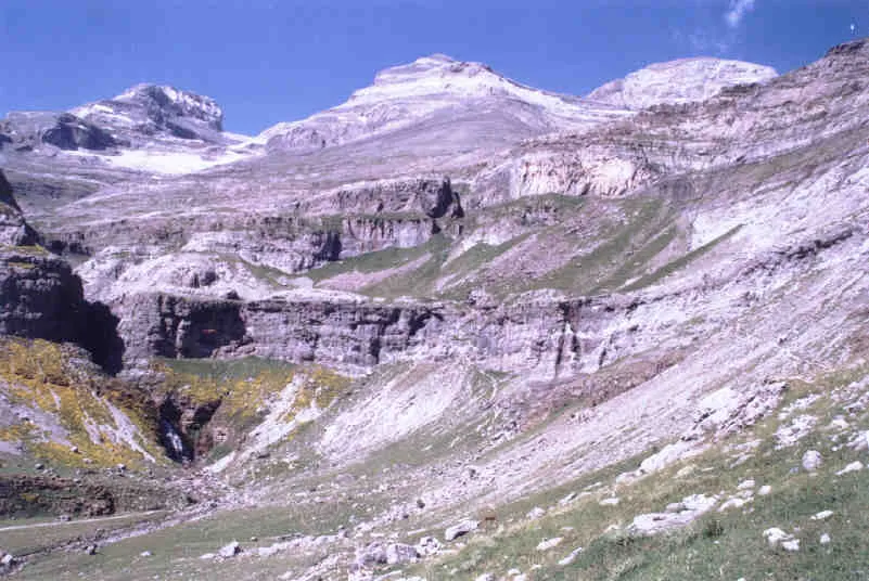
This outstanding mountain landscape, which spans the contemporary national borders of France and Spain, is centred around the peak of Mount Perdu, a calcareous massif that rises to 3,352 m. The site, with a total area of 30,639 ha, includes two of Europe's largest and deepest canyons on the Spanish side and three major cirque walls on the more abrupt northern slopes with France, classic presentations of these geological landforms. The site is also a pastoral landscape reflecting an agricultural way of life that was once widespread in the upland regions of Europe but now survives only in this part of the Pyrénées. Thus it provides exceptional insights into past European society through its landscape of villages, farms, fields, upland pastures and mountain roads.
Inscription details
| Field | Value |
|---|---|
| WHS ID | 773 |
| Inscribed | 1997 |
| Category | Mixed |
| Criteria | (iii)(iv)(v)(vii)(viii) |
| State party | Spain,France |
| Transboundary | Yes |
| French name | Pyrénées – Mont Perdu |
Protected monuments
| Monument | Commune | Protected |
|---|---|---|
| Ancien prieuré de Saint-Venant | Luynes | 1948 |
| Menhir de Montifray ou Pierre du Pont-Champion | Beaumont-la-Ronce | 1943 |
| Ancien asile d'aliénés | Le Mans | 2001 |
| Ancien Hôtel-Dieu de Dreux | Dreux | 1982 |
| Maison de Richelieu | Richelieu | 1932 |
| Eglise Saint-Pierre de Mur-de-Sologne | Mur-de-Sologne | 1926 |
| Vestiges de la porte Poitevine et la tour d'enceinte, ou Maillet | Loches | 1962 |
| Ancienne abbaye Notre-Dame-du-Bourg-Dieu | Déols | 1862 |
| Eglise Saint-Martin d'Etableaux | Le Grand-Pressigny | 1952 |
| Eglise de Saint-Germain-sur-Sarthe | Saint-Germain-sur-Sarthe | 1927 |
| Site archéologique dit de la Cave Peinte | Brain-sur-Allonnes | 1995 |
| Eglise de Saint-Georges-des-Sept-Voies | Saint-Georges-des-Sept-Voies | 1958 |
| Eglise Notre-Dame-des-Marais | La Ferté-Bernard | 1840 |
| Eglise Saint-Lubin de Landes-le-Gaulois | Landes-le-Gaulois | 1993 |
| Maison dite du Prèche | Montrichard | 1912 |
Loire appellations
| Appellation | Avg score | Reviews | Color |
|---|---|---|---|
| Sancerre | 89.3 | 554 | White |
| Muscadet Sèvre et Maine | 88.6 | 237 | White |
| Pouilly-Fumé | 89.6 | 153 | White |
| Vouvray | 88.4 | 153 | White |
| Touraine | 86.3 | 85 | White |
| Chinon | 88.7 | 72 | Red |
| Menetou-Salon | 87.3 | 69 | White |
| Crémant de Loire | 87.5 | 54 | Sparkling |
| Val de Loire | 85.6 | 41 | White |
| Saumur | 88.4 | 40 | White |
| Anjou | 87.6 | 36 | White |
| Rosé d'Anjou | 84 | 35 | Rosé |
Source: UNESCO World Heritage Centre. Updated: April 14, 2026.