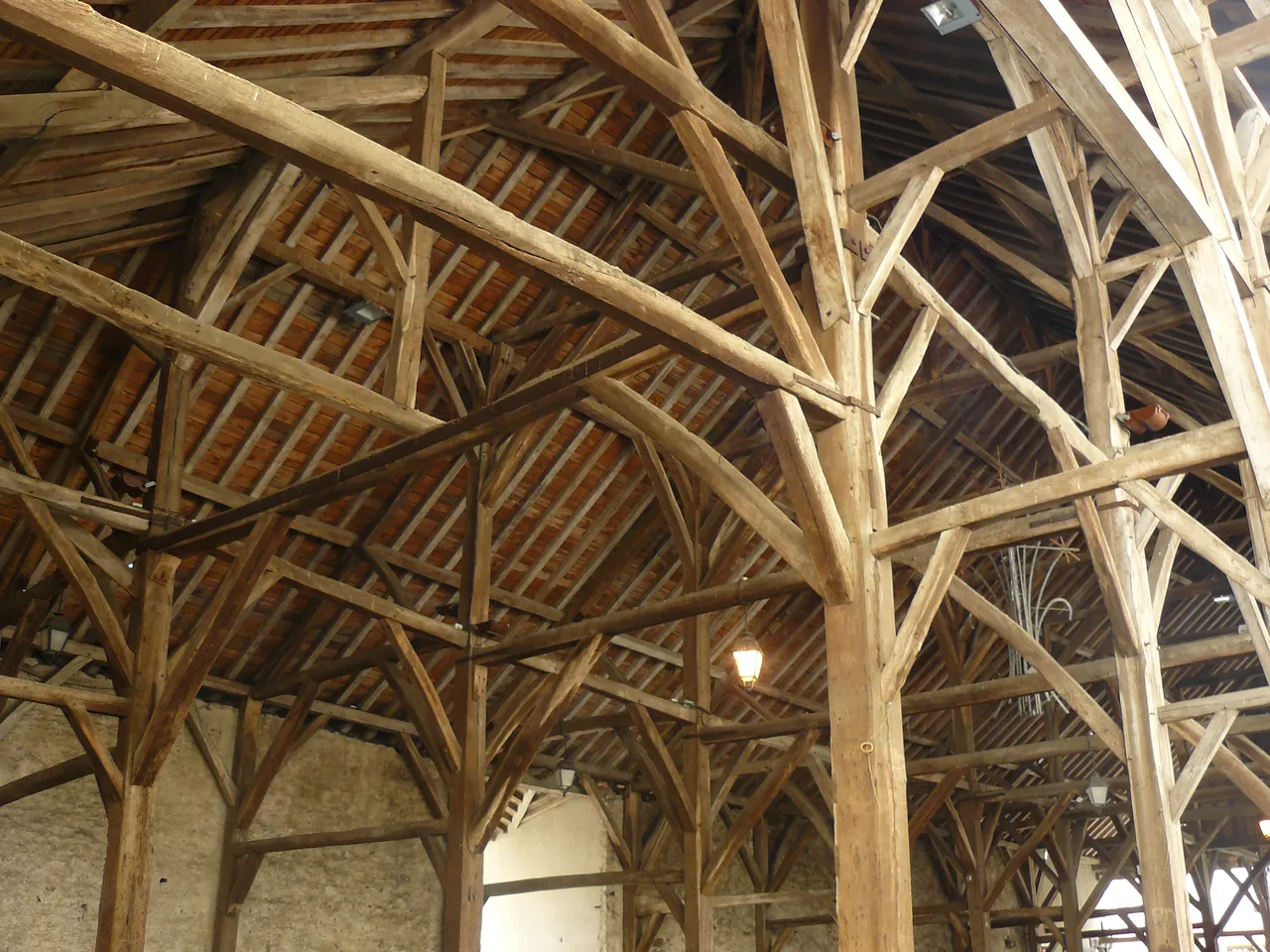
Halles de Clisson
marché couvert
Mérimée ID
PA00108591
French architectural heritage database reference.
Protection
Classé (1923)
Status under the French Heritage Act.
Identification & Protection
| Field | Value |
|---|---|
| Mérimée ID | PA00108591 |
| Type | Marché couvert |
| Protection | classé MH |
| Protection year | 1923 |
| Period | 17e siècle |
| Ownership | propriété de la commune |
| Commune | Clisson |
| Département | Loire-Atlantique |
Protection scope
Halles : classement par arrêté du 5 février 1923
View PA00108591 in the Mérimée database
Heritage of Clisson
10 other protected monuments share this commune.
| Monument | Type | Protection | Year |
|---|---|---|---|
| Domaine de la Garenne-Lemot | — | — | — |
| Pont sur le Moine dit Pont Saint-Antoine | Pont | classé MH | 1922 |
| Pont de la Vallée sur la Sèvres | Pont | classé MH | 1922 |
| Château de Clisson | Château | classé MH partiellement;inscrit MH partiellement;protection totale | 1924 |
| Eglise Saint-Jacques (ancienne) | église | inscrit MH | 1941 |
| Chapelle des Templiers (ancienne) ou la Madeleine du Temple | Chapelle | classé MH | 1975 |
| Porte de la Ville (ancienne) | Porte de ville | classé MH | 1984 |
| Villa de la Garenne-Valentin | Maison | inscrit MH | 1997 |
| Eglise de la Trinité de Clisson | église paroissiale | inscrit MH | 1997 |
| Eglise Notre-Dame de Clisson | église | inscrit MH | 2006 |
Other 17e siècle monuments in Loire-Atlantique
- Château de la Guibourgère (Teillé) — Château
- Eglise de Montrelais (Montrelais) — église
- Château de Retail de Legé (Legé) — Château
- Eglise Saint-Guénolé de Batz-sur-Mer (Batz-sur-Mer) — église
- Château de Goulaine de Haute-Goulaine (Haute-Goulaine) — Château
- Château de l'Epinay de Carquefou (Carquefou) — Château
- Château de la Motte-Glain (La Chapelle-Glain) — Château
- Château de Clermont de Le Cellier (Le Cellier) — Château
Heritage typology of Loire-Atlantique
| Edifice type | Count |
|---|---|
| Immeuble | 74 |
| Château | 51 |
| Maison | 35 |
| église | 26 |
| Menhir | 25 |
| Chapelle | 18 |
| Hôtel | 16 |
| Croix monumentale | 10 |
| Manoir | 10 |
| Dolmen | 9 |
| Moulin | 6 |
| église paroissiale | 5 |
* This monument is a marché couvert — one of 0 in the département.
Location
GPS: 47.0873°N, -1.2820°E (WGS 84).
Source: Ministère de la Culture — base Mérimée. Updated: April 14, 2026.
Geographic location
location_on
Clisson, Loire-Atlantique
Coordinates: 47.0873°N, -1.2820°E